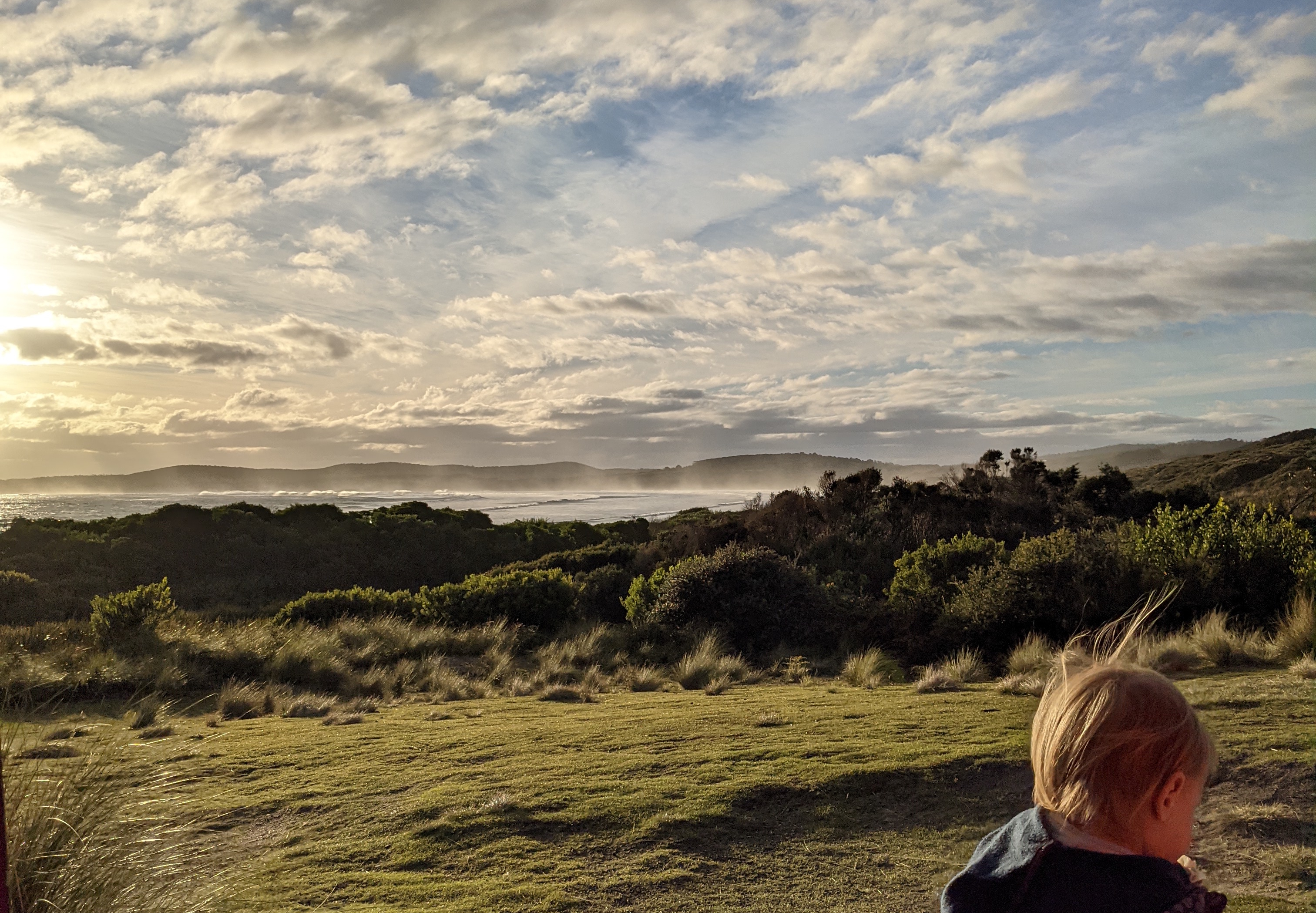
Remote imagery analysis of a Victorian estuary.
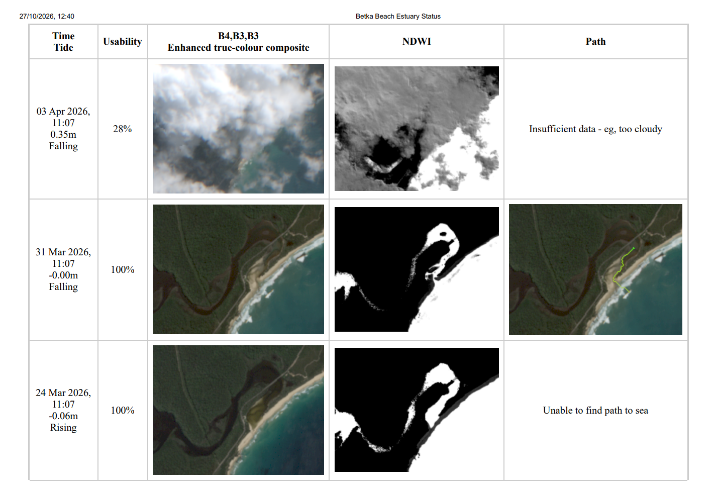
This report presents the output of a Python script that uses Sentinel satellite imagery to assess whether the intermittently closed estuary at the mouth of the Betka River in East Gippsland is open to the ocean. The script retrieves suitable imagery, computes tide levels, constructs a Normalised Difference Water Index (NDWI) composite, analyses cloud coverage, and performs path analysis to identify a potential water connection between the river and the sea.
The accompanying PDF presents the analysis of Sentinel imagery spanning several years.
The Betka River estuary is shallow and often narrow, making this a challenging application of Sentinel imagery. Other challenges include detecting when cloud cover inhibits accurate analysis and the potential limitations of NDWI when the opening is very shallow.
Monitoring seasonal changes in Australian waterways
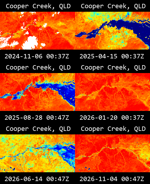
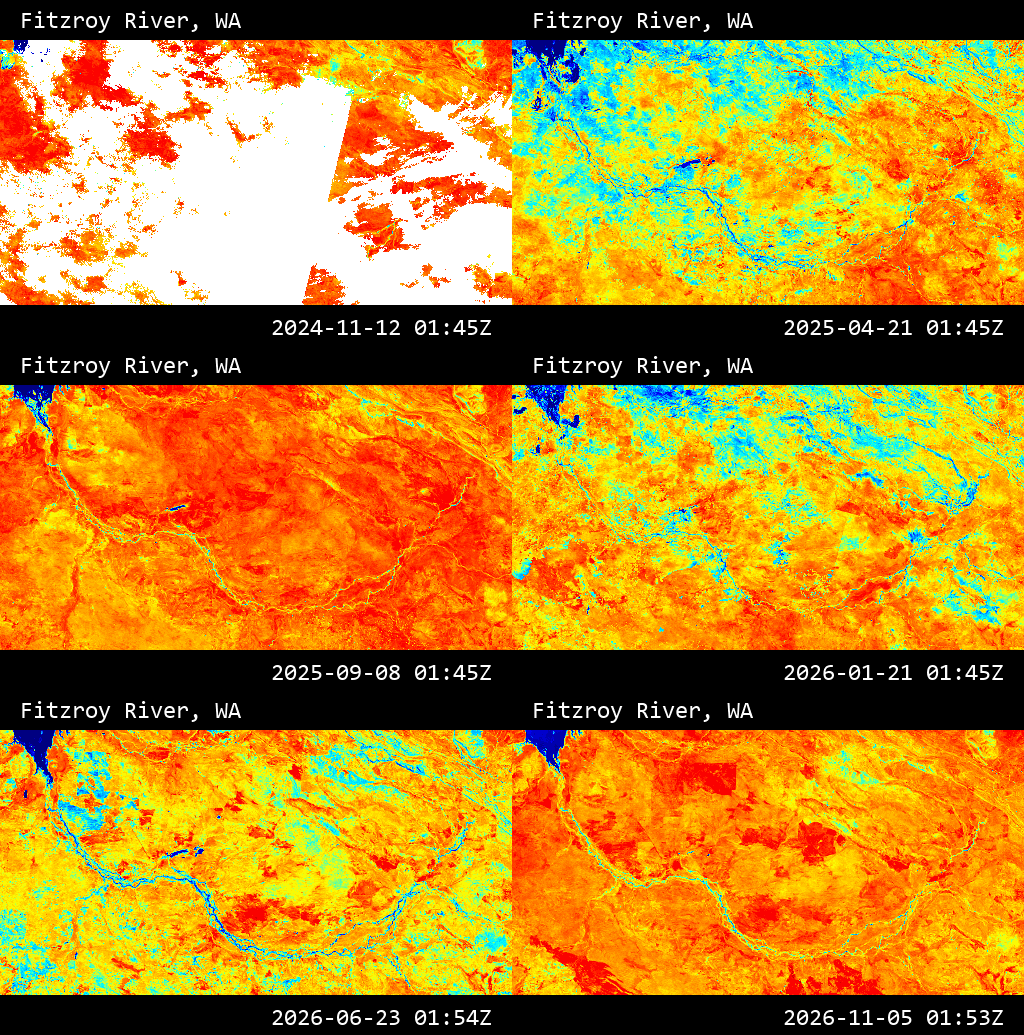
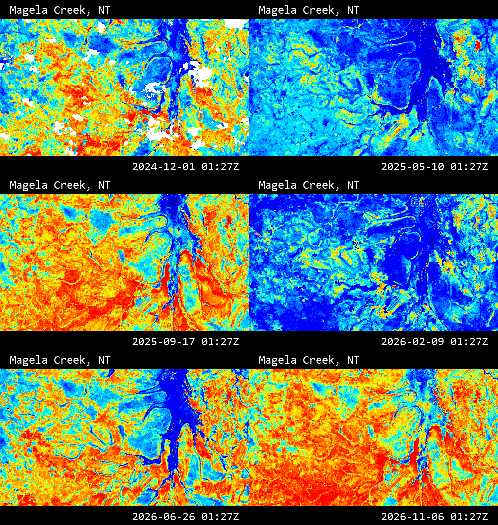
A Python workflow using Sentinel-2 imagery to generate a time-lapse GIF showing the NDMI (Normalised Difference Moisture Index) of a given map area.
Three examples of intermittent or seasonal waterways in outback Australia are shown. The NDMI is visualised using Sentinel Hub's standard red-to-blue moisture colour ramp where red represents dry conditions and blue represents wet conditions.
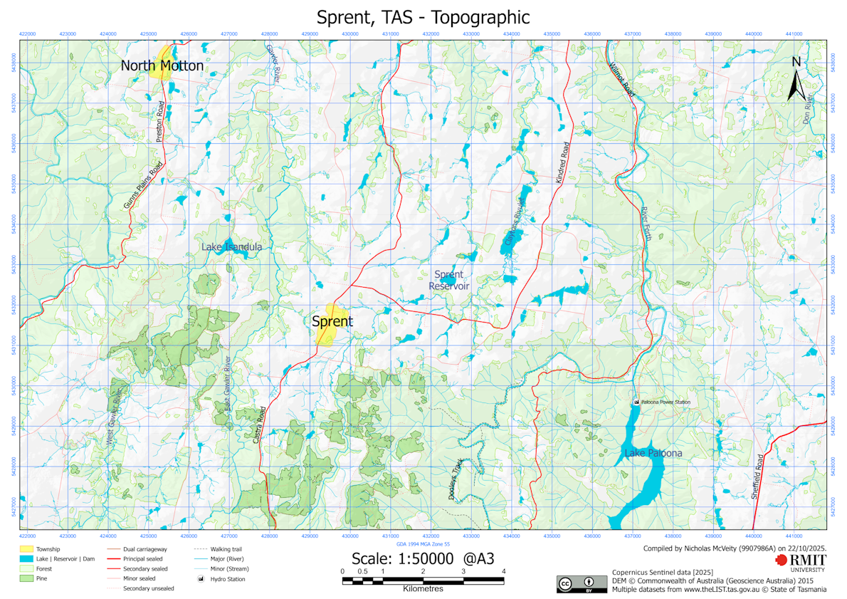
Topographic map of Sprent, Tasmania, and surrounds.
The map was generated by combining several open datasets from the Tasmanian Government with a supervised classification of Sentinel imagery to identify forests and differentiate pine plantations.
The township footprints were generated in FME by an algorithm that classified LGA zoning areas as town versus rural and then applied various spatial operations such as union and buffer.
All data was processed with FME, but the final styling and marginalia were applied with ArcGIS Pro.
Asset management survey
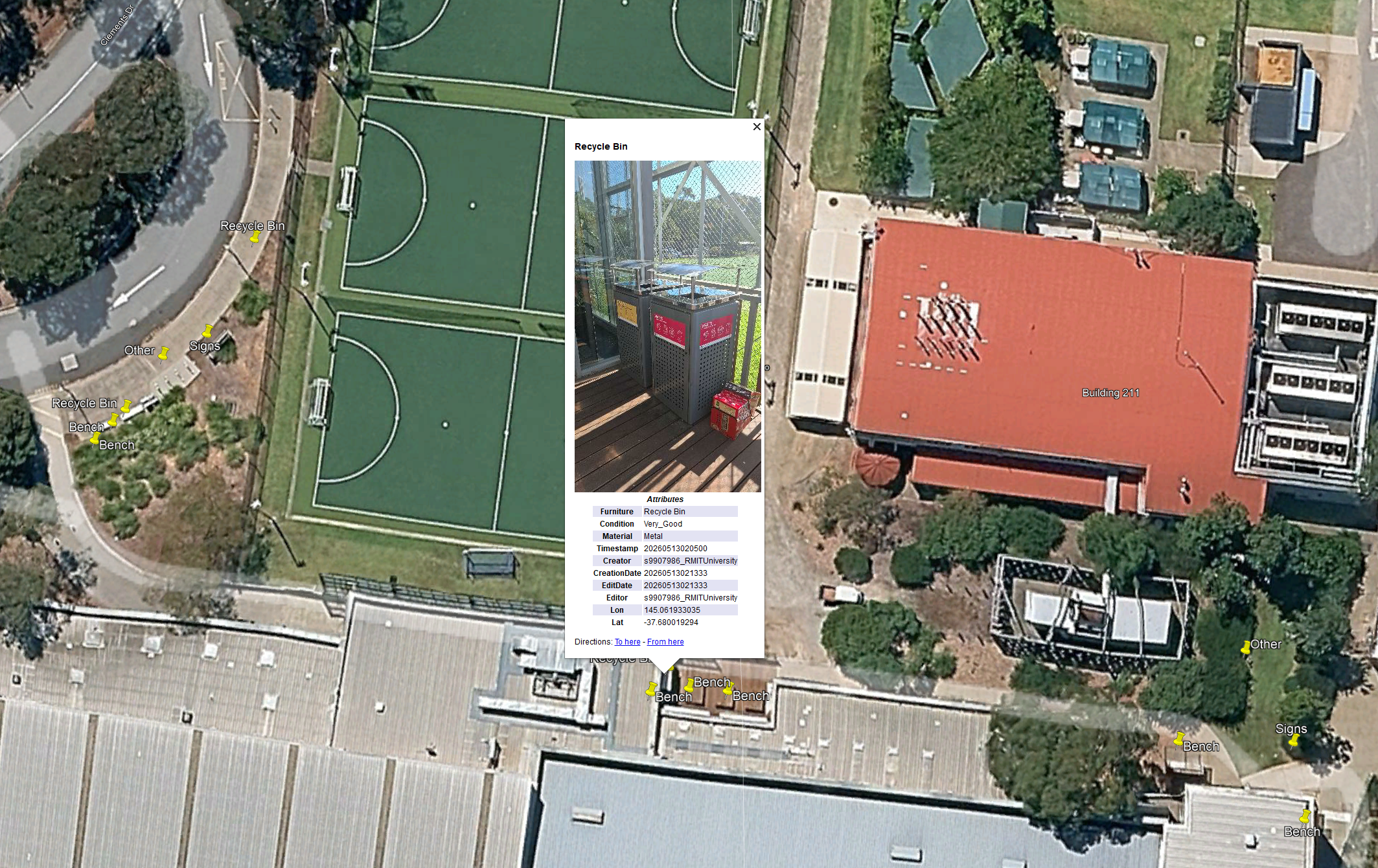
Our task was to accurately geocode all park furniture assets on the grounds of RMIT Bundoora West campus, recording each asset's location, photograph and condition.
Survey123 was used to collect the data with photographs and location data. Data was validated in Excel and ground-truthed against the final KML generated by FME.
Building access survey
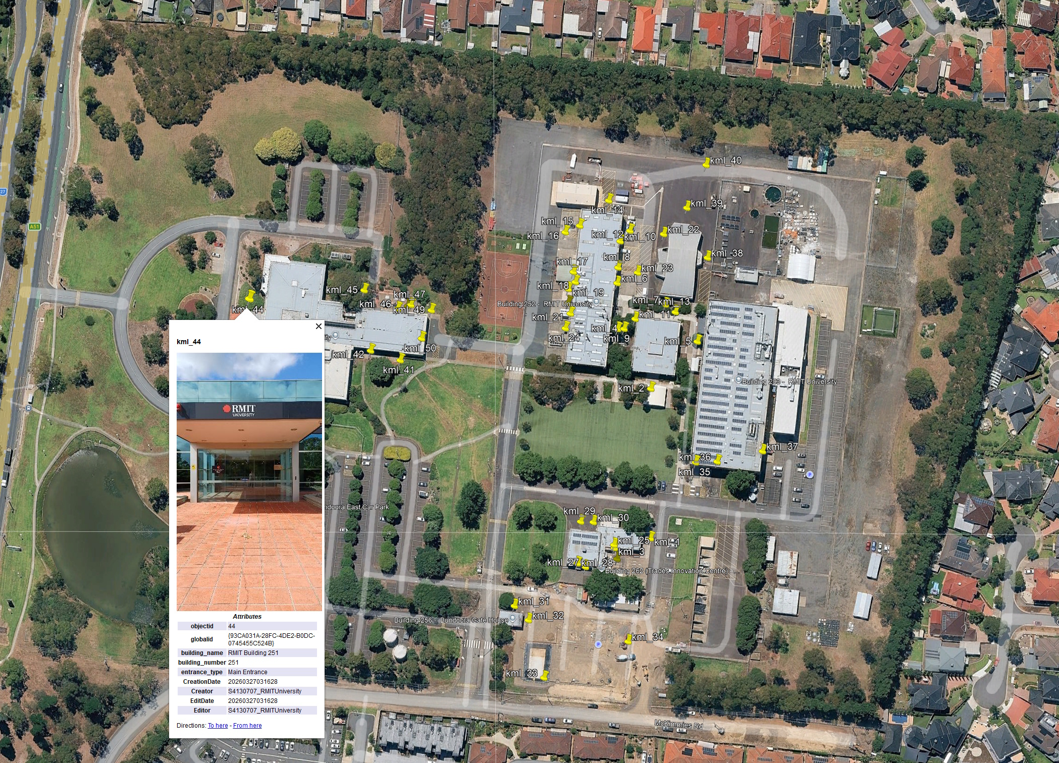
A location-based building access survey at RMIT Bundoora East, using Survey123 to record observations in the field.
Terrain visualisation
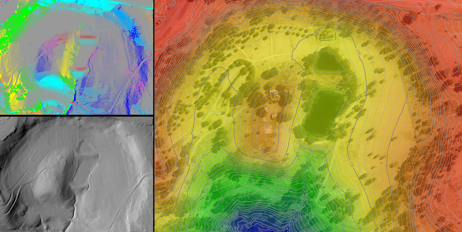
Terrain products derived from LiDAR elevation data, including hillshade, slope and aspect, using FME workflows.
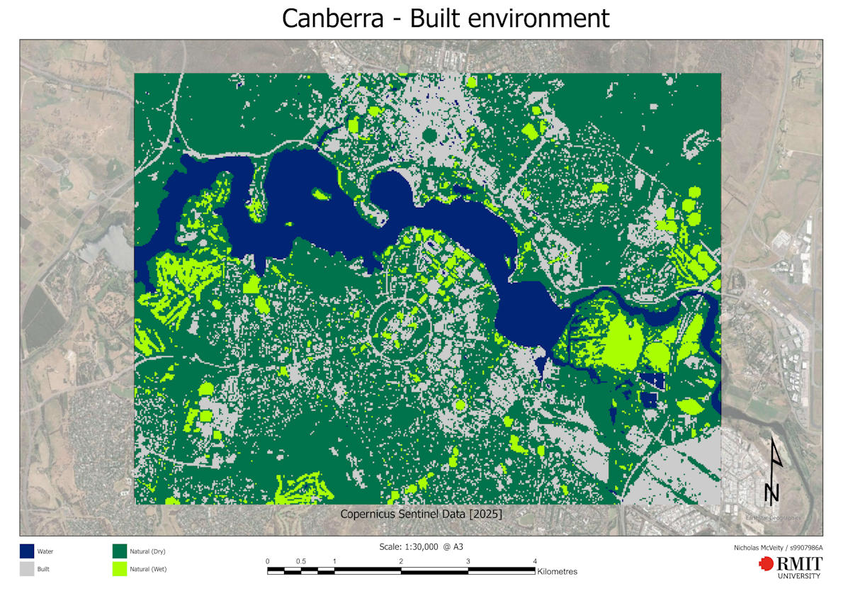
Classifying the built environment around Canberra
A remote imagery classification exercise examining built-up areas around Canberra.